
PLATFORM
AXİS — from Azərişıqtowards the whole utility network
Azərişıq Xəritə ilə İdarəetmə Sistemi
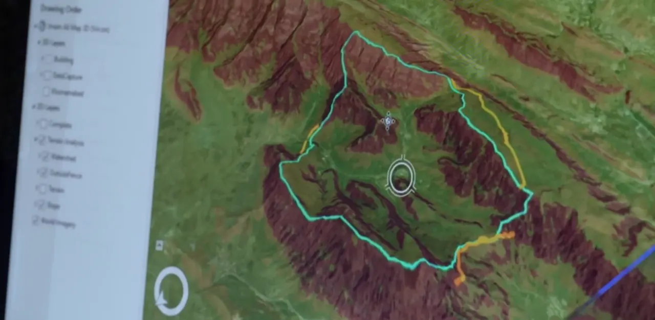
AXİS is a country-scale GIS platform already in operation at Azərişıq: it brings 2D/3D mapping, panoramic imagery, a mobile field application and reporting together on one screen.
Overview
In three words: the problem, the solution, the vision.
The AXİS platform — Azərişıq Xəritə ilə İdarəetmə Sistemi, the map-based management system — is already in operation at “Azərişıq” OJSC: its present capabilities, the benefits it has delivered, and, as it comes in future to cover every utility operator, the first national universal platform in Azerbaijan for managing the electricity distribution network from a single environment.
- 01
The problem
every utility operator — electricity, gas, water or heating — works in its own separate accounting system, unconnected to the others. There is no single location-based management platform.
- 02
The solution
AXİS, a country-scale GIS platform already in operation at Azərişıq: it brings 2D/3D mapping, panoramic imagery, a mobile field application and reporting together on one screen.
- 03
The vision
building, on the modular low-code architecture of AXİS, a Unified Utility Services Management Platform covering every utility operator.
Why now?
This initiative does not come from nowhere — it is a direction already settled at state level.
- 01
Under the “Utility connections” indicator of the World Bank’s Business Ready report, the 2022-2023 Roadmap instructed that the on-site inspection procedure during connection be replaced by GIS-2 and 3D mapping, and this was confirmed at Deputy Prime Minister level for 2024 as well.
- 02
More important still — both Cabinet of Ministers decisions, 399 and 315, use the phrase “Unified Information System for Utility Services” directly, and state that until that system becomes operational, connection procedures are carried out through the information system created by Azərişıq.
In other words, legislation already names the future unified system — and today we present its first working prototype.
What AXİS is today
AXİS is an enterprise asset management platform — a web and mobile application built as a comprehensive answer to the problem. It brings inventory tracking, 2D/3D mapping and panoramic imagery together with GIS-based visualisation and reporting tools in a single platform.
Before
- there was no universal single platform
- a large and complex inventory sat in disconnected records
- monitoring and reporting were done by hand
Now
- country-wide digital mapping is being carried out over 18 months
- a single registry is being built, from substation to meter
- everything is managed in real time through web and mobile
Scope of deployment
Technical basis
- PostgreSQL/PostGIS
- WGS84
- GeoServer
The project covers the digitalisation of the entire electricity distribution infrastructure — more than seven principal object types, from substations to transformer points, supports, lines and meters.
The target is 100 per cent territorial coverage — every regional, district and city network. The technical basis is a PostgreSQL/PostGIS database and the WGS84 coordinate system, with GeoServer used for the geographic data service.
01
substations
02
transformer points
03
supports
04
lines
05
meters
Core capabilities
The platform brings eight core capabilities together
- 01
GIS-based visualisation in layers
- 02
Cesium 3D digital twin
- 03
panoramic imagery and LIDAR point cloud
- 04
data entry and editing on the map
- 05
interactive reporting dashboard
- 06
AXİS Mobile field application
- 07
low-code rapid customisation
- 08
AI support through pro-code
The next few sections set out the most strategically significant of these in more detail.
01
Digital twin: 3D inventory
Through CesiumJS and 3D Tiling, the infrastructure is visualised together with buildings in a real 3D environment — a digital twin in the true sense.
Infrastructure can be tracked with precise elevation and geographic data, modelled in high-quality 3D, and the data of any asset — a support, a substation, a transformer point — reached directly from the 3D view.
02
Field operations: AXİS Mobile
For field crews, AXİS Mobile speeds up the collection and updating of site data, secures transmission over the corporate VPN, and gives direct access to inventory maps in the field.
From the office, Visuterra technology makes virtual field monitoring possible — 360-degree panoramas and LIDAR data are combined, so the work can be done as if on site without being there.
03
Reporting and flexible development
A live, map-based interactive 3D dashboard is available for the chairman and management. Every query can be exported as a table, a chart or Excel, and cross-layer queries can be run within the user’s permissions.
Technically, AXİS is not merely software but a development platform: low-code creates new object types and workflows without writing code, pro-code builds bespoke business logic in C# and JavaScript, and an integrated AI assistant helps produce that code faster and with fewer errors.
PLATFORM
The benefit already delivered
These are not theoretical capabilities — they are concrete results that have already happened.
STAGE01 / 04
SCHEMATIC
The drawing above is a schematic of the procedure, not a map. No coordinates and no measured distance are shown.
01
the on-site inspection procedure
The on-site inspection carried out in the subscriber’s presence when connecting to the electricity network is eliminated by means of GIS-3D.
STAGE01 / 04
SCHEMATIC
02
the connection point and the distance
From the electronic map, the system automatically determines the connection point to the existing network from the boundary of the land parcel, and the distance to it.
STAGE02 / 04
SCHEMATIC
03
ASAN Xidmət and ASAN Kommunal
At ASAN Xidmət and ASAN Kommunal centres, citizens’ applications are already reviewed through the Unified Map system
STAGE03 / 04
SCHEMATIC
04
part of the state service network
which means AXİS is already part of the state service network.
STAGE04 / 04
SCHEMATIC
The drawing above is a schematic of the procedure, not a map. No coordinates and no measured distance are shown.
TRADEMARK
AXİS is a registered trademark
Intellectual Property Agency of the Republic of Azerbaijan — Trademark certificate
- Certificate number
- N 2026 1173
- Holder
- “AZCİS” Limited Liability Company
- Priority date
- Entered in the state register
- Valid until
- Nice classes
- 35, 41
The next step: a Unified Utility Platform
On the working architecture of AXİS, proven at Azərişıq, it is possible to build a national platform uniting every utility operator — electricity, gas, water and sewerage, and heat supply — in a single map environment.
The electricity direction — Azərişıq — is already in place and fully operational. Azəriqaz for gas, ADSEA for water and sewerage, and Azəristiliktəchizat for heat supply are potential directions of expansion.
- ElectricityAzərişıqalready in place and fully operational
- GasAzəriqaza potential direction of expansion
- Water and sewerageADSEAa potential direction of expansion
- Heat supplyAzəristiliktəchizata potential direction of expansion
Why AXİS is the right foundation
This does not mean building a new system from scratch — it means extending an architecture that already exists.
- 01
Layer-based architecture
A layer-based architecture already exists: there are layers such as overhead lines, substations, TM/KTM and meters — new layers for a gas pipeline, a water main or a heating pipe can be added by the same logic.
- 02
Low-code development model
The low-code development model allows new object types to be created within hours, without writing code.
- 03
Infrastructure
The infrastructure — PostgreSQL/PostGIS, GeoServer, Node.js — has already been proven at national scale and can be scaled to carry additional load.
- 04
ASAN Kommunal
AXİS is already integrated with ASAN Kommunal — this makes a shared entry point easier for other operators.
Expansion scenario: a phased roadmap
The roadmap we propose has four phases.
- 01in progress
full deployment at Azərişıq
Full deployment at Azərişıq, country-wide mapping, mobile field work and ASAN integration.
- 0212-18 months
pilot expansion
pilot expansion — testing the shared layer structure with one additional utility operator, gas or water for example.
- 0318-30 months
full-scale Unified Platform
full-scale Unified Platform — integration of all principal operators and a single-window service.
- 04after 30 months
predictive maintenance
AI-supported predictive maintenance and a full digital twin of all utility infrastructure.
It is worth emphasising that each phase creates value in its own right, and the move to the next stage is formalised by a decision of the relevant state bodies.
National benefits of a unified platform
A unified platform brings six principal benefits at national level
- 01
single-window service
all utility connection requirements calculated from a single application, through a single-window service
- 02
the “Bir Dəfə Qaz” coordination principle
preventing different operators from carrying out repeated excavation work on the same ground
- 03
the Business Ready ranking
further progress in the World Bank’s Business Ready ranking
- 04
IT investment efficiency
IT investment efficiency, by sharing common infrastructure instead of building a separate platform for each operator
- 05
in emergencies
instant assessment, on a single map, of the impact on every utility network in an emergency
- 06
unified urban-planning analytics
all utility infrastructure supporting unified urban-planning analytics from a single source
Next steps
We propose four concrete steps to move from concept to decision
- 01reaching an initial agreement with Azəriqaz, ADSEA, Azəristiliktəchizat and the relevant state bodies
- 02defining the pilot cooperation framework and the pilot territory with one additional operator
- 03preparing implementing documents on the basis of the existing decisions on the “Unified Utility Information System”
- 04assessing the financing model for the pilot and for full-scale expansion
In conclusion
In summary, AXİS today is a working platform, proven at Azərişıq and supported by decisions at state level. Its modular, low-code architecture is the most suitable foundation for building a Unified Utility Services Management Platform covering every utility operator.
It is a real, technically ready path to the “Unified Information System for Utility Services” that legislation already provides for.
The information on this page is taken from the AXİS presentation material.
Let us put your project on the map.
Get in touch with the AZCİS team about your infrastructure, engineering or geospatial project.